How to make your own map - Overview
Most Garmin GPS units accept only vector data*. Therefore, creation of map for GPS in Mapwel software involves several steps from calibration of raster scan or satellite image to upload of vectorized map to Garmin GPS. It is also possible to import vector data from various file formats and sources. Since version 2009, build 6.6, Mapwel software supports creation of routable maps with turn-by-turn navigation.
To get started with drawing of simple map, please click on any below step to see simple example:
Raster files used in above examples are mw.jpg and mw2.jpg. They can be found in MAPWEL > FILES folder.
Some of these steps are not necessary if your input data are already vectorized and stored in a file format supported by Mapwel software (ESRI shapefiles, OSM, GPX, MP, KML, KMZ) or if they are already georeferenced.
* some new Garmin GPS models support raster images wrapped into Google Earth's KMZ file format.Following table outlines the steps needed when working with a specific data source:
|
Working from scan, aerial or satellite image (raster image) |
Working from georeferenced image (OziExplorer or GeoTiff file) |
Working from vector file (ESRI shapefiles, MP, OSM, GPX files) |
|
|
Image calibration |
required | ||
|
Drawing of vector objects |
required | required | optional |
Only the most frequently used methods are shown in above table. Each of them can be combined with use of your own tracks and waypoints imported from GPS, map files in OSM or GPX format downloaded from internet, etc.
Performance of map in GPS device (visibility at various zoom levels and speed of rendering) depends heavily on hierarchical structure of map data.
There are several ways how to create vector objects for the map
- Manual drawing of objects
- Automatic vectorization of whole raster image
- Automatic tracing of objects from raster image
- Freehand drawing with mouse or tablet
- Import of tracks and waypoints from GPS
- Use of ESRI shapefiles
- Use of OpenStreetMap *.OSM files
- Merging of other Mapwel files or other compatible files (*.MP, *.OSM, *.GPX, *.KML, *KMZ, etc.)
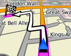
Routable maps (maps with voice turn-by-turn navigation)
- Conversion of existing map into routable map
- Manual drawing (vectorization) of routable roads
- Import from OpenStreetMap *.OSM or cGPSmapper *.MP file
- Import from ESRI shapefiles
Options to manage maps in your GPS
- Erase specific map in GPS
- Add map to maps already present in Garmin GPS
Options to load raster images into GPS
- Calibrated image wrapped into Google Earth's KMZ file - better quality, but supported by few GPS models only
- Automatic vectorization of raster image - worse quality, but works for more Garmin GPS models
Large map for GPS created with Mapwel is supposed to be composed from tiles (smaller individual maps), forming a map set. Typical size of individual map (tile) is less than 100 x 100 km, please refer to the limits chapter. Each tile is compiled separately. Compiled tiles are merged into single map set file.
In case of problems with map uploading or displaying on Garmin GPS, please check the Troubleshooting chapter.