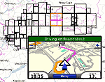
Garmin Nuvifone M20
Garmin Mobile XT
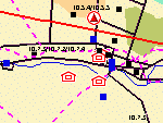
Garmin Aera
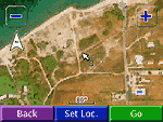
Garmin Oregon
Garmin Dakota
Garmin Colorado
Garmin Montana
Garmin Astro
Garmin Nuvi and Zumo (all models) - most of them do not display symbol (point) icons *
Garmin Edge 605, 705, 800
Garmin iQue M3, M4, M5
Garmin eTrex 20, 30
Garmin eTrex Summit HC
Garmin eTrex Venture Cx, HC
Garmin eTrex Legend C, Cx, HCx
Garmin eTrex Vista, C, Cx, HCx
Garmin Rino 120, 130, 520, 530, 520HCx, 530HCx
Garmin GPS V
Garmin GPSMAP 60C, 60CS, 60Cx, 60CSx, 62, 62s, 62st
Garmin GPSMAP 76, 76S, 76C, 76CS, 76Cx, 76CSx, 78, 78s, 78sc
Garmin GPSMAP 176, 176C, 276C, 376C, 378, 478C
Garmin GPSMAP 96, 96C, 196, 296, 396, 496
Garmin GPSMAP 620 - only routing maps in automotive mode **
Garmin Quest, Quest 2
Garmin Street Pilot i2, i3, i5
Garmin Street Pilot c320, c330, c340
Garmin Street Pilot c530, c550, 580
Garmin Street Pilot 2610, 2620, 2650, 2660
Note:
Most of above GPS devices require Garmin USB driver installed on your computer. Otherwise, Mapwel and MapUpload does not detect the GPS on the USB port. This driver is available for download at Garmin web site.
Known limits
Custom maps from Mapwel do not allow to search destination by name/address on many units.
* Most Nuvi and Zumo models do not display point icons from custom maps, or they display them only in 2D mode and at a very close zoom.
** Custom map from Mapwel works with GPSMAP 620 only if it is a routing map (contains routable roads) and the device is in automotive (not marine) mode.
NOTE: Mapwel is not affiliated with any manufacturers mentioned here.
All brand names and product names are trademarks of the respective manufacturers