Mapwel - GPS Mapping Software
Create custom maps with navigation
for Garmin mapping GPS devices
Build your own map for GPS
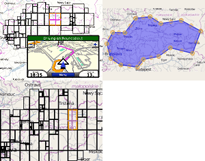
Mapwel is mapping software for PC or laptop that allows you to create your own maps for GPS, compile them into GPS compatible format (.IMG) and upload your custom maps to GPS.
It works with Garmin GPS devices.
Map format
The most common
input data are ESRI shapefiles, OpenStreetMap OSM files, Google Earth KML and KMZ files, OziExplorer .MAP files, cGPSmapper .MP files and geotiff images.
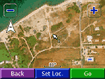
The main output of Mapwel is custom GPS map with optional routing (voice navigation) in IMG file format. Furthermore, export to KML map format helps to check your map calibration on Google Earth satellite imagery. Export to KMZ files allows direct use of georeferenced raster images in some of the Garmin GPS units.GIS to GPS conversion
Wizard for import of ESRI shapefiles from GIS applications allows quick conversion of shapefiles into Garmin GPS compatible map format.
Import procedure includes selection of projection and datum and building of
conversion table between shapefile attributes and Mapwel object properties.
Settings can be saved to a file for re-use with the same or similar shapefile.
Map authoring tool
Mapwel makes all above steps within a single authoring tool, using its own map compiler and MapUpload utility.
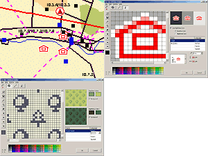
Mapwel software also allows to georeference the raster images, create and edit vector map objects, download vector maps from Open Street Map,
create custom patterns, icons and colors for the map, and analyze the road network of maps with navigation.
Use of maps
Custom GPS maps created with Mapwel software are
mostly used in forestry, electrical engineering, geology, geodesy, mineralogy, aviation, real estate, geocaching, land management, hiking, snow mobiling and other fields where unique custom GPS maps are needed.
Contact Us
Privacy Policy
By staying on our website you agree to our use of cookies to enhance your experience.


